Tag: Hong Kong

  • Tai Mo Shan Hike: Reaching the Top of Hong Kong

    Tai Mo Shan Hike: Reaching the Top of Hong Kong

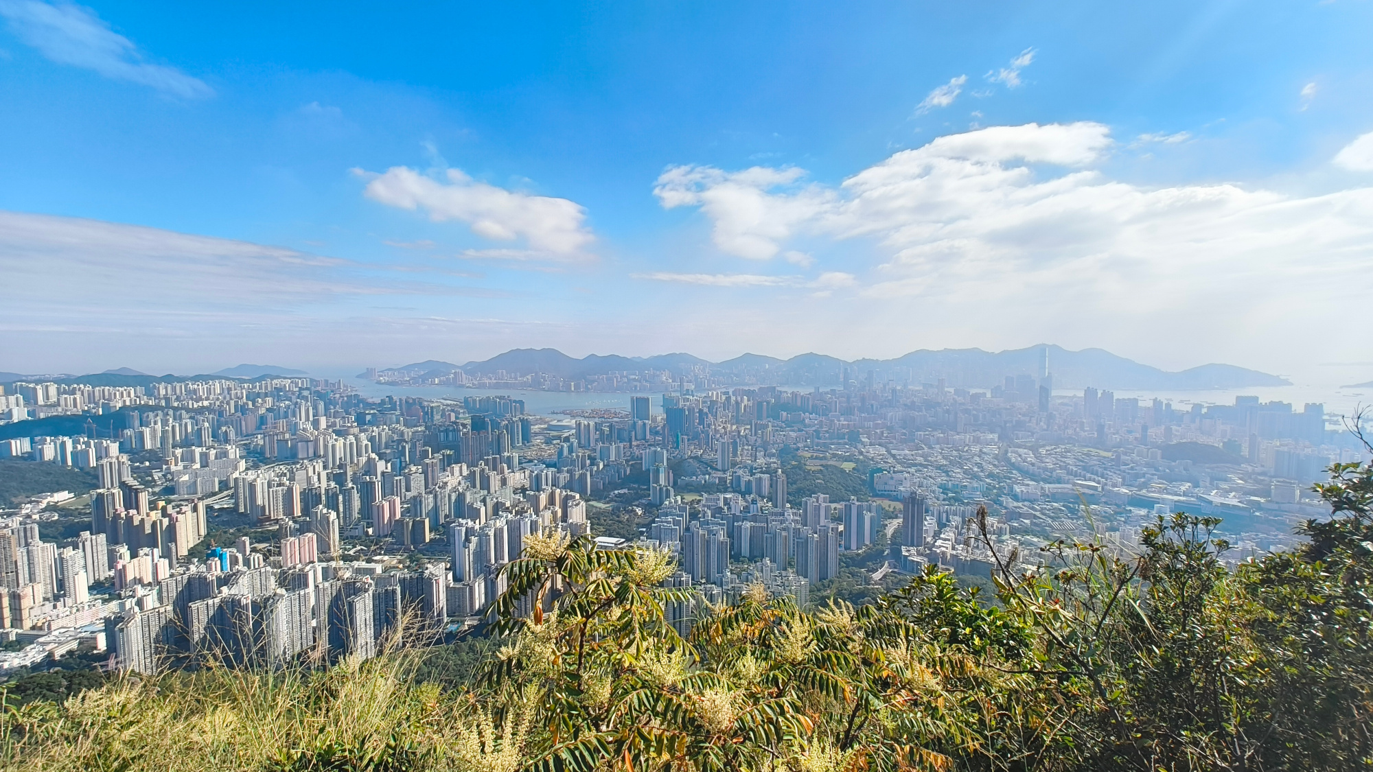
    In addition to its (sometimes stressful) urban environment, Hong Kong is renowned for its well-preserved countryside parks, offering a welcoming contrast to the cityscape. The terrain is predominantly hilly, with Tai Mo Shan standing as the highest peak in the region at an elevation of 957 meters. This height is comparable to that of neighboring Lantau Peak on Lantau Island and Mount Wutong in Shenzhen, China. Although the summit is occupied by a radar and military station and is therefore inaccessible to the public, the hike to the peak offers breathtaking panoramic views. To the north, you can gaze out over the landscape, while to the south, the vistas extend towards Kowloon and Tuen Mun. On a clear day, you can even see Shenzhen, Hong Kong Island, and the surrounding islands in the distance.

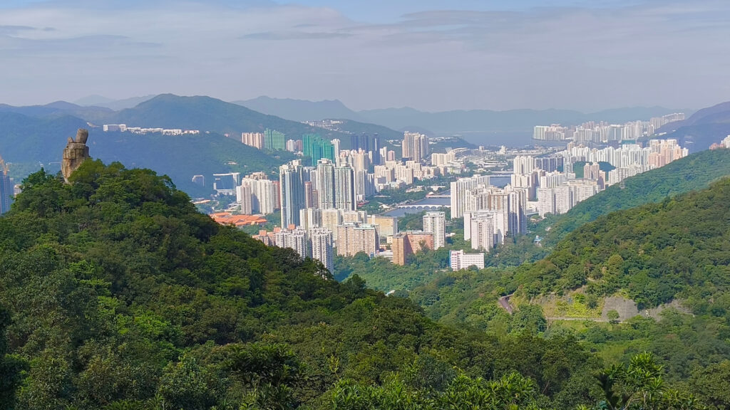
    Panoramic view near Yin Ngan Peak (679m)

    To hike Tai Mo Shan, there are many access points, primarily from the west starting at Route Twisk or from the east via Leadmine Pass. In this blog, I’ll introduce you to the route starting from Tai Po. You can take minibus 23K to its last stop at San Uk Ka Village, which begins at Tai Po Market. From there, follow the road uphill, which is also part of the Wilson Trail Section 7. After about 15 minutes, look for a small footpath with stairs on your right. Take this path, which leads into a small forest featuring a mix of flat sections and steep inclines.

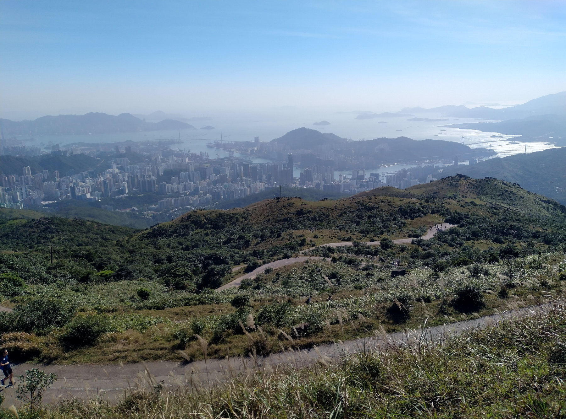
    Soon, you’ll reach Leadmine Pass, a great spot to take a break, refill your water, and use the public toilet. At an elevation of around 400 meters, Leadmine Pass offers a convenient resting point. To the east lies Grassy Hill, while further south, the Shing Mun Reservoir stretches out. From here, we decided to head west directly towards Tai Mo Shan.

    Be aware that a very steep section of the trail lies ahead, with an elevation gain of around 200 meters. Take it slow and steady—soon, the terrain will flatten out as you reach one of the many subpeaks, such as Yin Ngan Peak (679 meters). From this point onward, the trail can become very exposed to the sun, so it’s advisable to prepare sun protection, especially on a clear day.

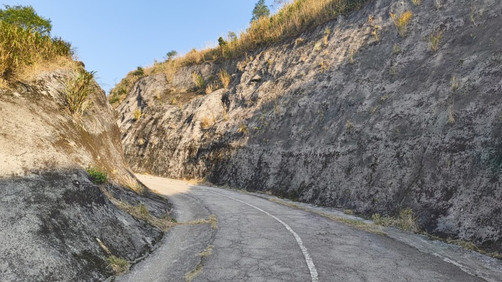
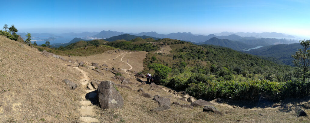
    Follow the trail, and you’ll soon reach a road (closed to cars). Continue along this road as it leads you toward Tai Mo Shan. Be prepared for the final stretch—the last few hundred meters to the peak are very steep. As you ascend, don’t forget to pause and look northward for stunning views of Shenzhen and the New Territories.

    If you plan your time ahead, you can also plan to be at the peak for sunset. I observed the sunset several times at Tai Mo Shan at it was always a magical amount. When descend you can follow down the street. Unfortunately at some point it is open to public cars, and many drivers are not used to the hilly and narrow environment so try to keep safe. However, there is a small footpath to your right which allows you to descend through the forest on the MacLehose Trail. I would recommend the path unless it is already dark.

    Once you reach the peak you will get a view towards the Soutwest towards Tuen Mun. From here, it is about 45 min back to the bus station. Once you reach Route Twisk, you can take a bus back to Tsuen Wan. Keep in mind that on weekdays, buses run only once every 60 minutes, but on weekends, the frequency increases, making it easier to catch a ride.

    The hike begins with a shaded path. However, as you progress, the trail becomes increasingly exposed.

    Length11.8 km
    Uphill/Downhill920 m/480 m
    Highest PeakTai Mo Shan(957 m)
    Recommended SeasonAutumn to spring

    Download GPX-File: Tai Mo Shan from Tai Po

  • Book Review: Cantonese since the 19th Century

    Book Review: Cantonese since the 19th Century

    Cantonese is predominantly a spoken language, and its written form is primarily used in modern and informal contexts, such as text messages. For formal written documents, Standard Chinese is employed. This distinction poses challenges for researching the usage of Cantonese in earlier times, as there are limited audio recordings and written texts available. Consequently, for spoken Cantonese in the 19th century, only a few sources, such as language learning books from that period, exist.

    The book Cantonese since the 19th Century by Hung-Nin Samuel Cheung, published by the Chinese University of Hong Kong Press, is a collection of several articles that examine this topic in greater detail. Since these articles were previously published in scientific journals, they are loosely connected to one another. Additionally, the academic language used may challenging for readers unfamiliar with such terminology, potentially hindering their engagement with the subject.

    In the articles, the author attempts to reconstruct early spoken Cantonese by examining various sources, including language manuals, popular songs and their rhyme schemes, as well as village names found on old maps of Hong Kong. Overall, readers who are familiar with Cantonese can gain valuable insights into the history of the language, as well as an understanding of the different dialects within Guangdong Province. Moreover, this book serves as an initial introduction to language research, though it may not be an easy read for all.

    As a Cantonese learner, I found the examination of grammar topics particularly interesting. For instance, one article explores the evolution of question formation, highlighting how the structure Verb + Not + Verb (verb 唔 verb…呀?) has become the predominant form in contemporary spoken Cantonese. Additionally, I learned about the changes in word usage, such as the transition from the perfective aspect marker 曉 to the currently used 咗.

    Cantonese since the 19th Century

    Hung-Nin Samuel Cheung

    The Chinese University of Hong Kong 2023 (ISBN: 978-988-237-253-5)

    361 pages; also available in Chinese

  • Lion Rock Hike

    Lion Rock Hike

    Lion Rock, an iconic symbol of Hong Kong culture, is located in the northern part of the Kowloon Peninsula. Standing at an altitude of 495 meters above sea level, it offers an accessible hike for intermediate to experienced hikers—though summer hiking is not recommended due to the heat.

    There are multiple trails leading to the summit, some of which are quite short and feature a series of steps for a quick ascent. In this post, I’d like to introduce you to my favorite route, which starts at the northern Shatin end of Lion Rock and concludes on the Kowloon side.

    A shadowed trail on top of Amah Rock

    You can enter Lion Rock Country Park at the Hung Mui Kuk Barbecue Area. To get there, you have two options: exit the East Rail Line at Tai Wai for a short but less appealing walk, or take a bus to the nearby bus station. Once you arrive at the barbecue area, you’ll likely encounter families and groups of friends grilling their food and enjoying lively conversations. Be cautious of the monkeys, as they can sometimes become aggressive.

    Shortly after leaving the barbecue area, you’ll cross a small stream, which provides a perfect spot for a brief break. Take a moment to breathe and appreciate the beauty of nature. As you continue, the sounds of the bustling city will gradually fade away. You’ll then cross a small road and follow the trail over a bridge.

    At this point, you have two options: you can take the left trail directly up toward Lion Rock, or you can opt for a small detour to see Amah Rock. I enjoy the view over Shatin, so I often choose to climb Amah Rock first. The trail is short but steep, leading you to the summit.

    In Chinese, Amah Rock is known as 望夫石 (Mong Fu Shek), which translates to “husband watching stone.” According to legend, it tells the story of a fisherman’s wife who would climb the hill daily, gazing out for her husband’s return. Unfortunately, he never returned, as he had drowned at sea. Transformed into stone, she continues to watch over Shatin, forever waiting for her husband’s return. From Amah Rock you can follow the trail through the forest reaching Reunification Pavilion. On this occasion you will have your first view over Kowloon. On a clear day, you can oversee the whole area until Hong Kong Island.

    Climbing up Lion Rock

    From the pavilion, head left and then shortly after, take a right. You will encounter a steep incline with stairs. Take your time, especially if the day is humid. After about 30 minutes of climbing, you’ll reach the top, starting with the Lion Rock head. It can be a bit challenging to navigate the head itself, so feel free to skip this part if you prefer; the views from other areas of the peak are equally impressive.

    At the summit, you’ll be rewarded with an 360-degree view of the New Territories, Kowloon, and even Hong Kong Island. Take a moment to rest and soak in the scenery. Please note that the peak is not protected, so be cautious if it’s sunny or windy.

    Continue your journey to the tail of Lion Rock. From there, you can descend using a flight of stairs. At the bottom, you’ll cross a major hiking trail, which you can follow to the right.

    Eating Tofu Fa at Shatin Pass

    After hiking for about 30 minutes along the major trail, you’ll reach a low-traffic road (Shatin Pass Road). You can choose to descend immediately, but if you walk up for just a minute, you’ll find a small store at the gap selling refreshments and snacks. Be sure to try some Tofu Fa with sugar or ginger syrup—it’s a refreshing and rewarding treat after your hike.

    From there, you can follow the road downhill. After a few minutes, look for a small trail with stairs on your left. Take this path to visit the Buddhist Kwun Yam Temple. Afterward, you can conclude your hike at the Tsz Ching Estate.

    Trail details

    Mostly shadowed path with exposed areas on the top of Lion Rock

    Length5.5 km
    Uphill/Downhill410 m/340 m
    Highest PeakLion Rock (495 m)
    Recommended SeasonAutumn to spring

    Download GPX-File: Lion Rock With Amah Rock